
Sources for Margate Neighbors
No public list identifies every person on a Margate block. The useful sources describe parcels, owners, recorded interests, public voter registrations, city maintenance responsibility and civic contacts. Together they can outline the block, but each has a clear limit. Property records concern ownership, and an association contact list is not a resident roster.
| Block source | What it reveals nearby | Access route |
|---|---|---|
| BCPA map | Parcel edges and click-through owner records | Free pan, zoom and click |
| BCPA parcel roll | Owner, mailing and situs addresses, sales and exemptions | Free record search |
| Official Records | Deeds, liens, plats and recorded relationships | Online by date; office fallback |
| Margate GIS | Street grid, subdivisions, zoning and maintenance | Maps or requested analysis |
| Election extract | Public fields for unprotected active and inactive voters | Monthly state data |
| HOA, CDD and Watch contacts | Management or joining contacts, not members | City-published contacts |
The best first source is BCPA because one screen separates the property's situs, or physical location, from the owner's mailing address. When they match, owner occupancy becomes more plausible, but it is still not a household census. A deed confirms a recorded transfer, not every adult who lives on the lot.
Map the Margate Block
The BCPA Maps and Aerials viewer supports the adjacent-parcel method. It does not document a one-click radius tool. Instead, locate the subject, zoom until lot lines and streets are clear, then inspect each bordering polygon. Previous and Next parcel links offer a second way to move through the assessment sequence.
- Search the starting address and verify the street direction, number and city.
- Zoom to parcel polygons, click the subject lot, then each lot sharing an edge.
- Open each parcel card and record the owner, situs, mailing address, folio and sales date.
- Compare the results with the plat or subdivision. Ask Margate GIS for a defined 500-foot analysis when exact radius work is needed.
This flow stays focused on immediate Margate neighbors. The Margate street directory handles a whole named street and its longer owner-to-deed chain.
The manifest-captured BCPA parcel record template shows the type of card opened from the map.
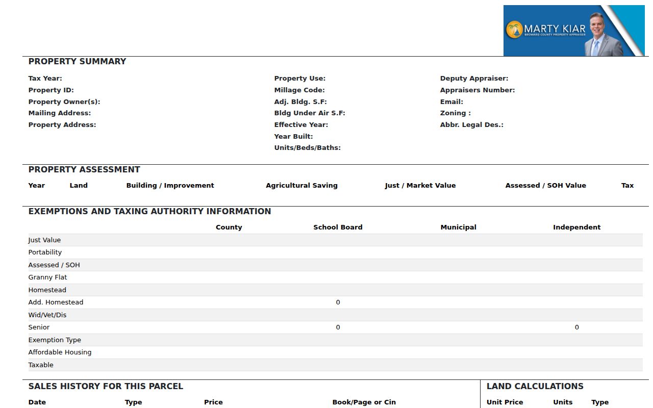
Its separate situs and mailing fields are vital because a nearby owner may receive tax mail somewhere else.
Canals Shape Margate Neighbors
Margate has roughly 30 miles of canals within a planned street network. Numbered streets and avenues may look continuous on a text list while water, subdivision walls or a different access road separates the lots. That is why a parcel view is more reliable than assuming the next house number is part of the same walkable block.
The city's January 2023 address map shows NW and SW prefixes, major roads, subdivisions and the street grid. BCPA supplies tax-roll situs addresses, while USPS controls the mailing city and ZIP. Deeds and plats carry the stable legal description. When these labels disagree, lot, block, subdivision and folio are better anchors than a typed address alone.
Margate GIS can prepare custom maps, charts, reports and mailing lists and specifically offers a 500-foot zoning-radius analysis. Engineering/GIS works from 901 NW 66 Avenue, Suite A, and city maps are approximate rather than surveys.
Public Voter Data Near Margate
Florida's monthly voter extract can add a public registration layer to a block, but it is not a live household list. Registration and participation history are public. Social Security numbers, driver-license identifiers, registration-location facts and protected addresses are withheld. Voters covered by confidentiality rules are omitted.
The Florida voter extract page explains the public file and its specifications.
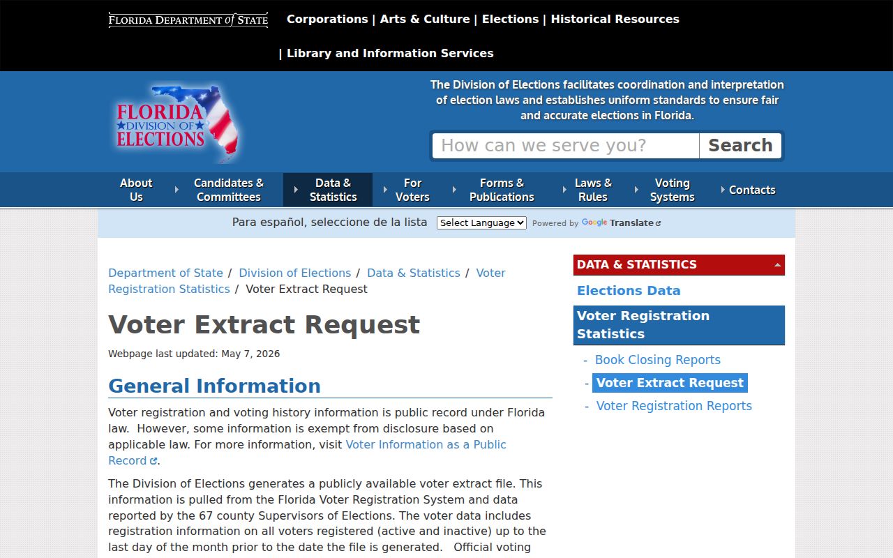
Use the extract only after the parcel map defines the block, and never treat an omitted voter as proof that no one lives there.
The Broward Supervisor of Elections supplies local precinct and registration resources.
Precinct boundaries are election geography, so they can be much larger than the nearby parcels being checked.
Margate District and HOA Contacts
The city's maintenance list identifies associations and community development districts responsible for certain streets or sidewalks. It provides management contacts, not a directory of Margate neighbors. Coral Bay CDD includes The Cape, Fay's Cape, Indian Key, Islamorada, Las Brisas, Las Brisas Del Mar, Mallory Harbor and Port Antigua. Cypress Cove has its own CDD.
| Community group | Named local areas | What the city source supplies |
|---|---|---|
| Coral Bay CDD | Eight listed Coral Bay subdivisions | District and maintenance contact |
| Cypress Cove CDD | Cypress Cove | District contact |
| HOA-maintained developments | Carolina Club, Juniper Glen, Montara, Enclave, Fairway communities, Greens and others | Management contact, not members |
Margate Police Community Relations coordinates Neighborhood Watch meetings, security inspections, crime-prevention talks, National Night Out and Coffee with a Hero. These are sound ways to join civic life. No official public watch-participant roster or citywide HOA member directory was found, and none should be inferred.
Official Rolls Beat Neighbor Tools
Commercial neighbor-search products combine data from many sources and can merge same-name people, retain old addresses or hide useful detail behind a subscription. Official rolls are narrower, but they reveal who keeps the record, what the field means and how to correct it. Neither category is a household census.
| Source type | Strength | Main limit |
|---|---|---|
| BCPA and county records | Custodian, folio, dates and legal context | Owners and recorded parties, not all occupants |
| Elections data | Defined public fields and local precinct context | Protected people omitted |
| Commercial tools | May suggest a name or old address | Stale merges, unclear sourcing and possible cost |
Use a commercial result, if encountered, only as a clue. Confirm it at BCPA, the Clerk, elections or the city office that owns the actual record.
Request a Margate Block Record
When a city map or dashboard does not answer the question, Florida Public Records Law allows a focused request for an existing nonexempt record. Margate accepts requests through JustFOIA, email, phone, fax, mail and the City Hall counter. The city need not create a new report, and exempt details can be redacted.
State the address or defined parcel set, record type, date span and preferred electronic format. Ask for an estimate before extensive labor. For an exact 500-foot mailing area, contact Margate Engineering/GIS rather than claiming BCPA has an undocumented buffer button. For deeds, obtain the owner or folio first and then use Broward Official Records.
Note: A narrow parcel list reduces delay and cost while keeping the request tied to records the custodian already maintains.
Privacy for Margate Neighbors
Renters, children and other household members do not appear merely because a parcel owner does. Mailing addresses may be elsewhere, a homestead marker can lag a sale, and utility or delivery records should never be inferred. Florida's Address Confidentiality Program supplies a substitute address to eligible survivors of domestic violence and stalking. Other statutory classes can shield home details as well.
Florida stalking and cyberstalking law, section 784.048, covers threats, harassment and repeated unwanted contact. Public access never grants permission to watch a person, publish protected data or press for contact after someone says no. The safest use is ordinary civic research, learning how a block is laid out, or making contact through a public association channel.
Property ownership also changes on a different clock from daily life. BCPA warns that a homestead exemption stays on the roll through the calendar year of a sale and is removed the next January 1. A newly recorded buyer may therefore appear beside a homestead flag tied to the seller. Sales history and the deed date should be checked before using that marker as evidence about Margate neighbors.
Community contacts provide a safer route than building a private roster. Margate Police Community Relations can connect residents with Neighborhood Watch meetings, fraud seminars, security inspections, and public events. A named HOA or community development district can address shared maintenance questions. Neither office publishes a verified member list, and participation in a civic event does not prove where a person lives.
Canals make restraint practical as well as legal. Two parcels that look close in a numbered address list may not share access or even the same subdivision. Confirm bordering parcel polygons in BCPA, use the city address map for the street grid, and ask Margate GIS when a formal 500-foot analysis is needed. Do not expand a block search merely to collect more names.
Voter data needs another limit. The monthly extract omits confidential voters and does not show how anyone voted. A person absent from the file might be unregistered, protected, recently moved, or indexed under a different spelling. Parcel ownership, voter registration, and current occupancy are three separate facts. The neighbors workflow should keep them separate instead of blending them into one household claim.
For a wrong parcel field, save the folio, tax year, and page viewed before contacting BCPA. For a city map issue, send Margate GIS the exact address and a clear description of the discrepancy. Those offices can review their own records. An association manager cannot correct the tax roll, and the elections office cannot revise a deed. Sending each question to its custodian prevents a casual neighbor search from turning into a chain of unsupported corrections.
Lawful use. Research Margate neighbors for lawful civic or personal reasons. Never use a record to stalk, harass, threaten or evade protected-address rules.